



IGAD Cross-Border Clusters & Regional Maps
Explore maps covering cross-border clusters, transhumance routes, animal health facilities, livestock trade facilities and other regional infrastructure across the IGAD region.
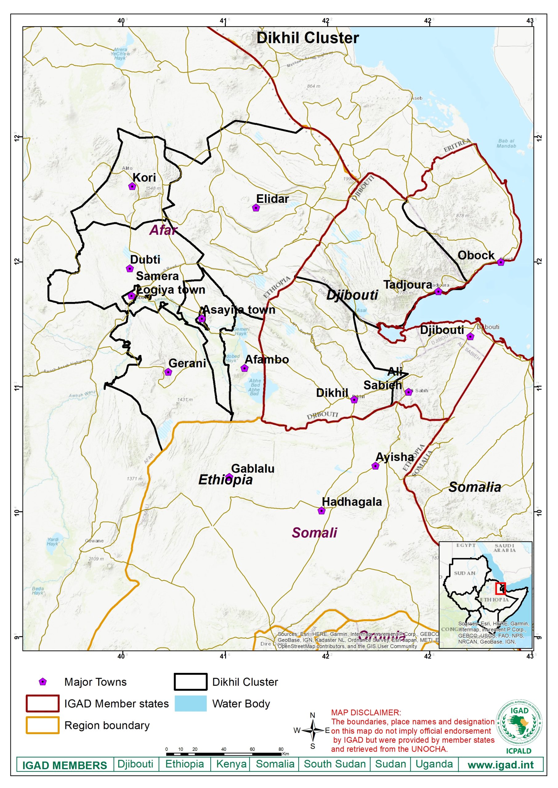
Dikhil Cluster
Cross-border cluster map covering the Dikhil area within the IGAD region.
View full map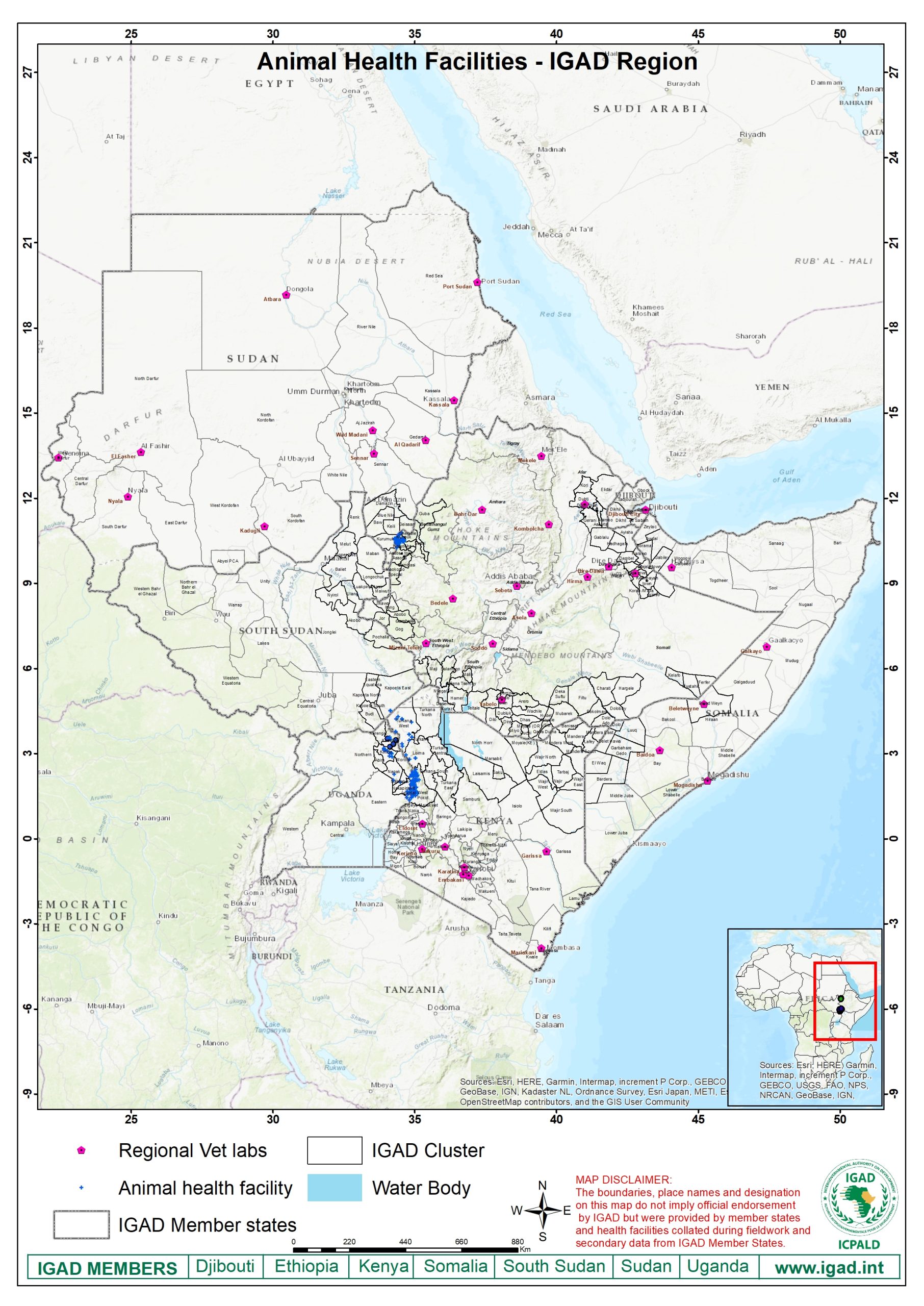
IGAD Animal Health Facilities
Regional distribution of animal health facilities across IGAD cross-border areas.
View full map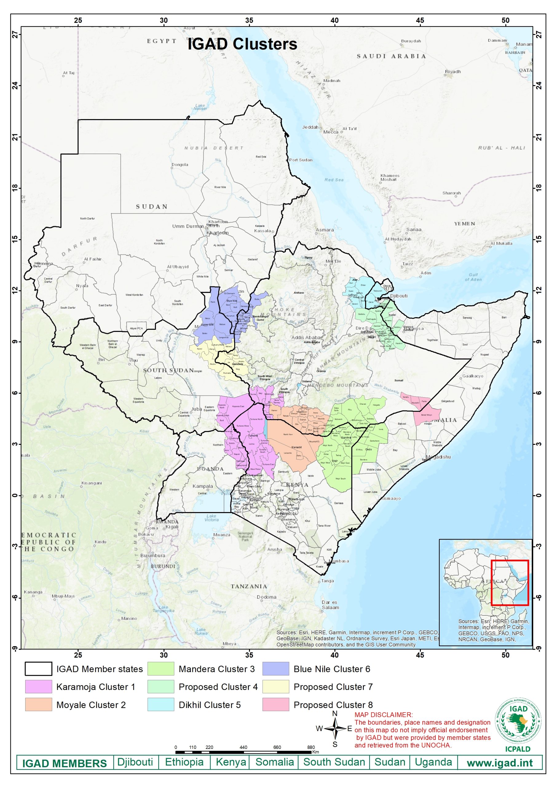
IGAD Cross-Border Clusters
Regional overview of the key cross-border clusters across the IGAD region.
View full map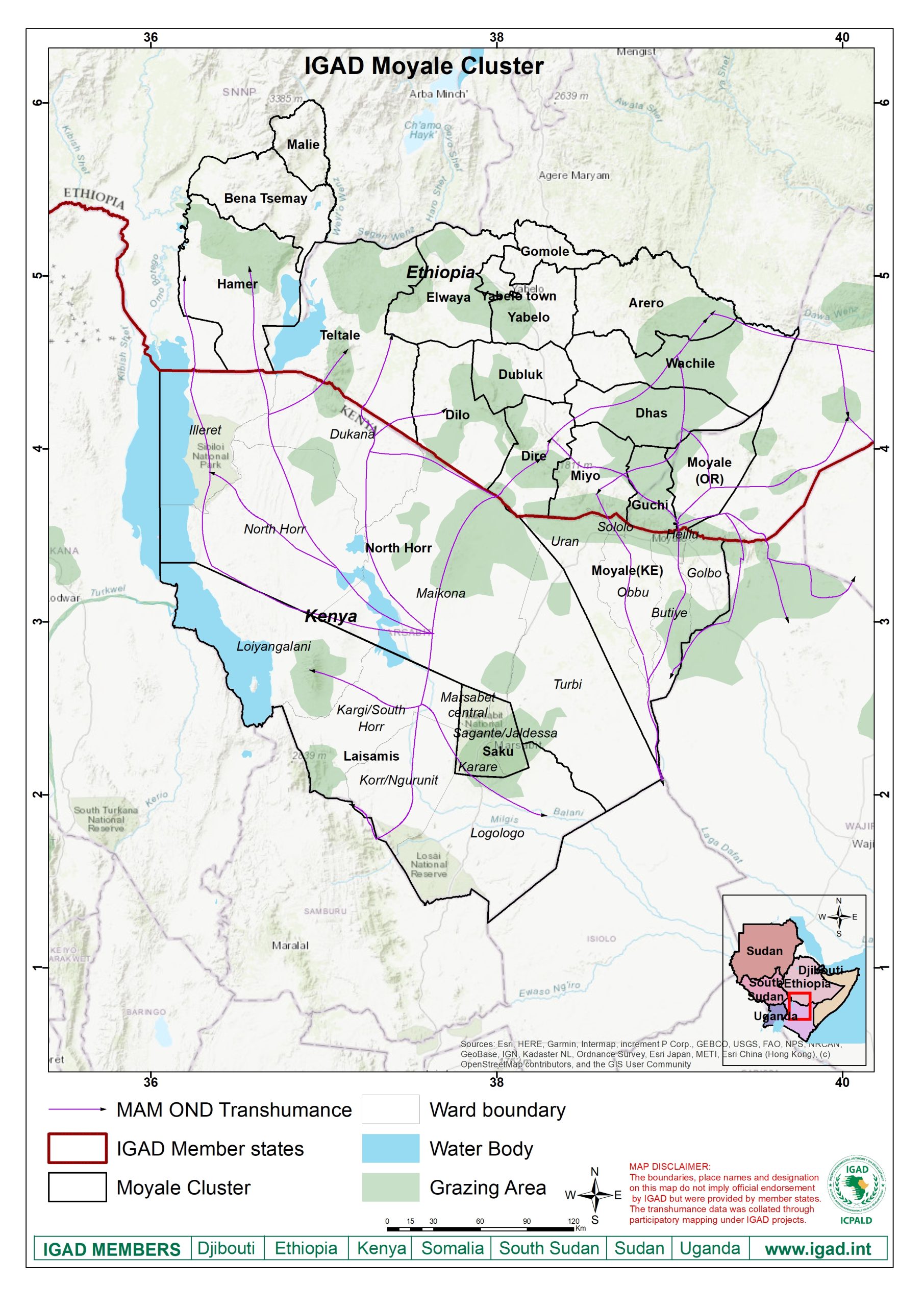
Moyale Cluster
Map of the Moyale cross-border cluster and surrounding areas within the IGAD region.
View full map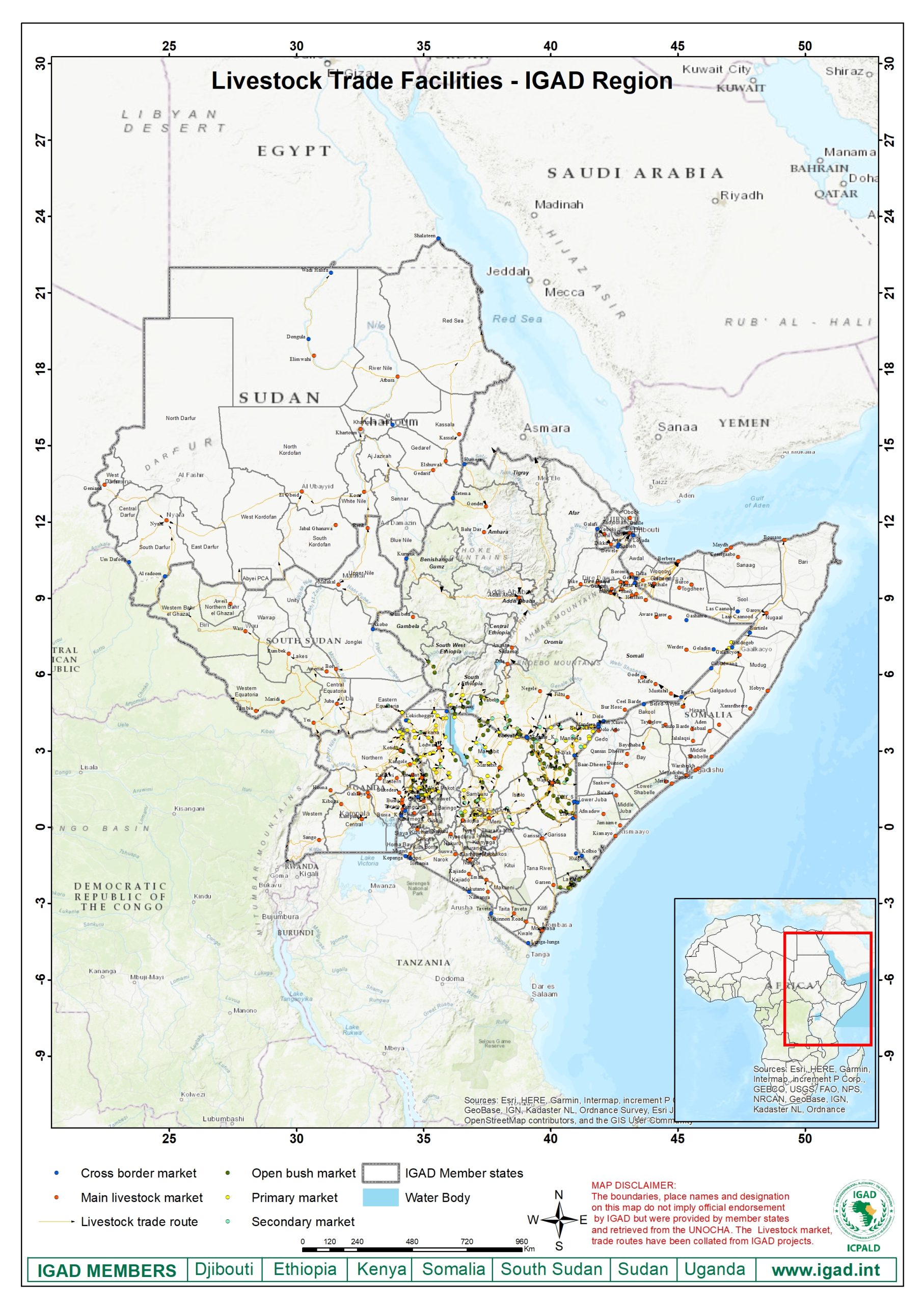
IGAD Trade Facilities
Regional map showing livestock and cross-border trade facilities across IGAD areas.
View full map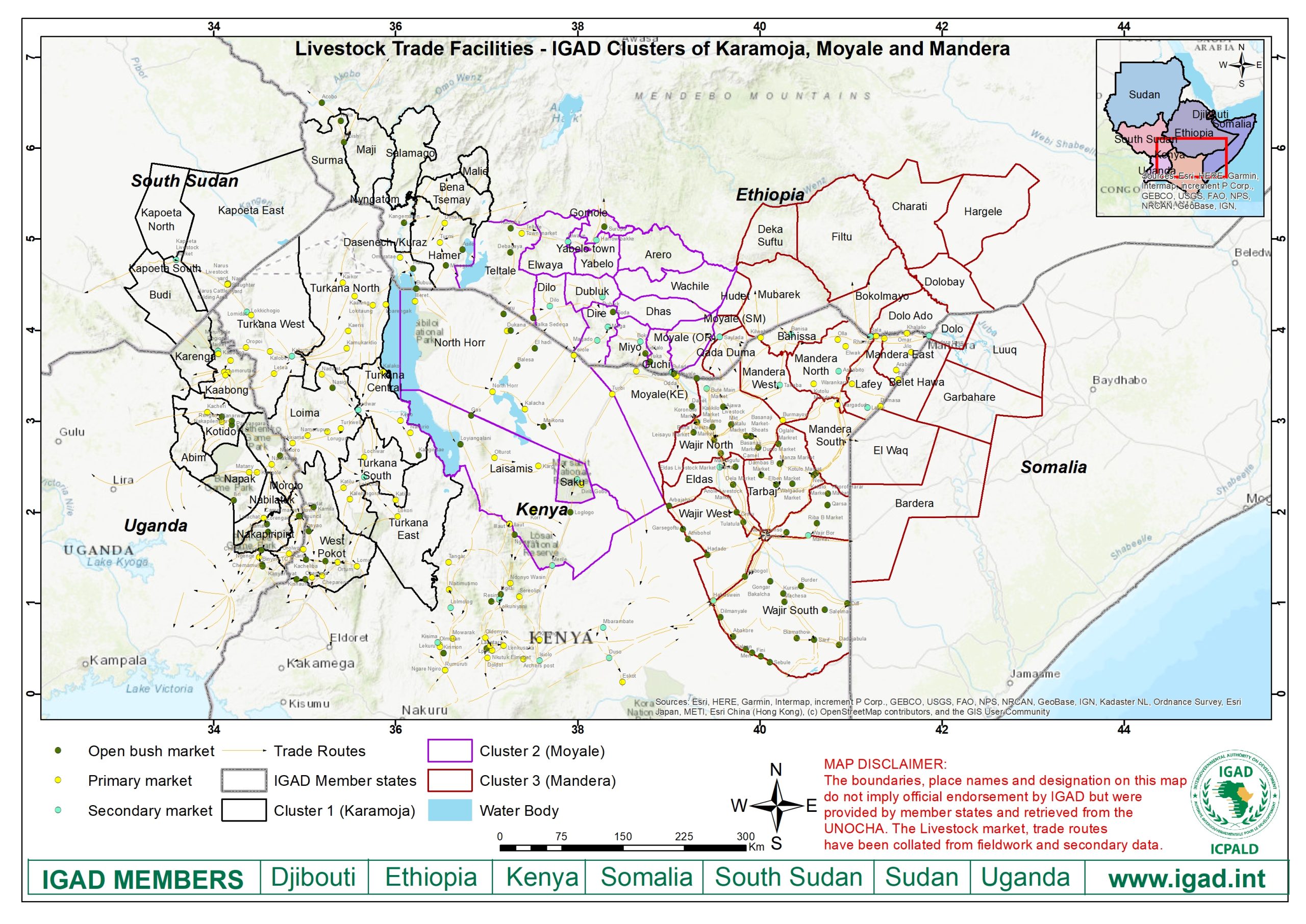
Trade Facilities – Clusters 1, 2 & 3
Trade facilities serving IGAD cross-border Clusters 1, 2 and 3.
View full map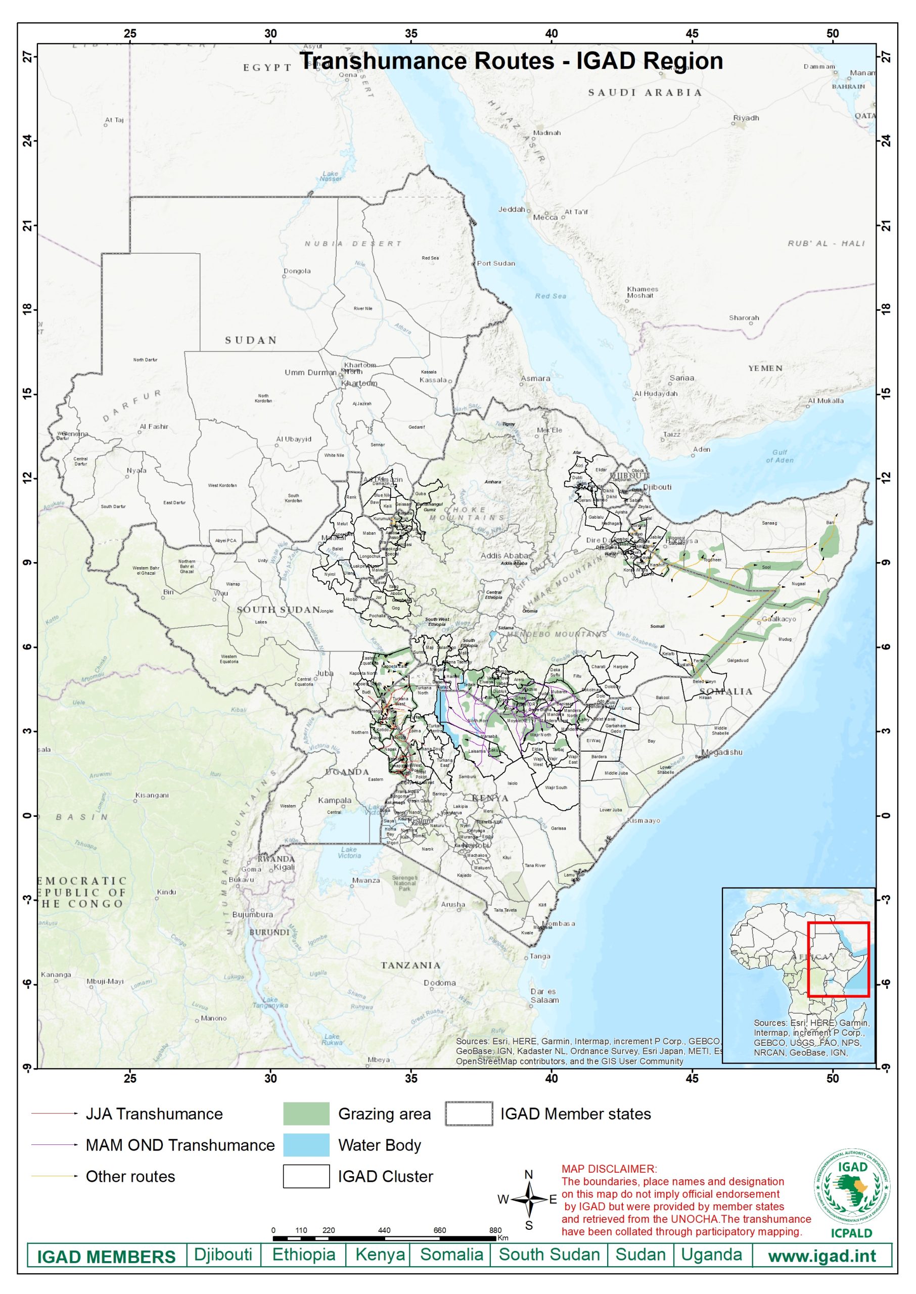
IGAD Transhumance Routes
Overview of major pastoral and transhumance routes within the IGAD region.
View full map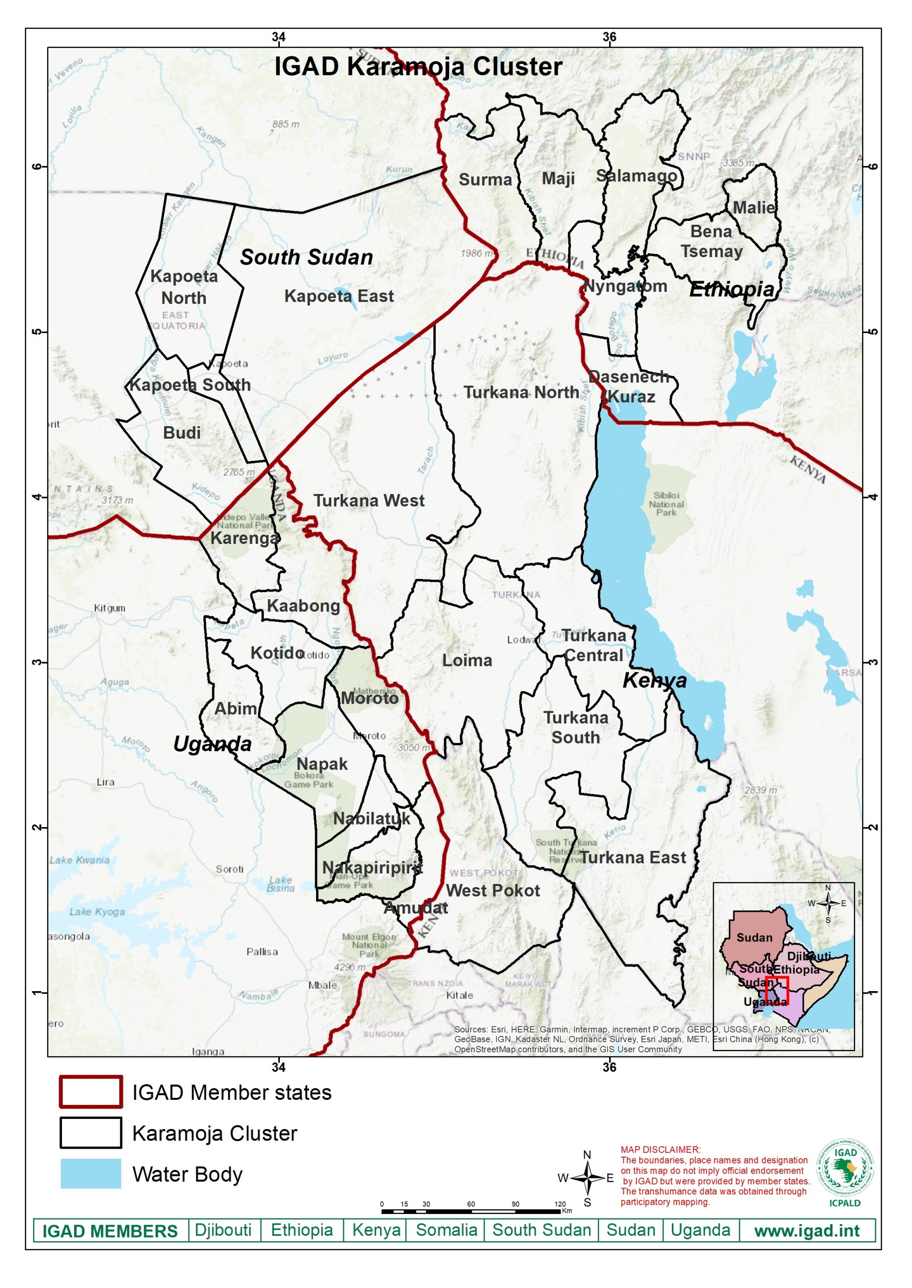
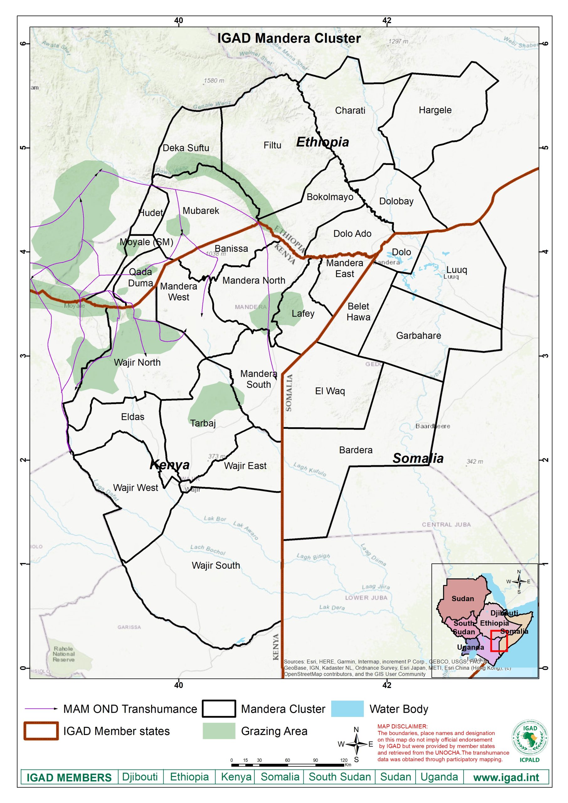
Mandera Cluster
Cross-border cluster map covering Mandera and surrounding regional areas.
View full map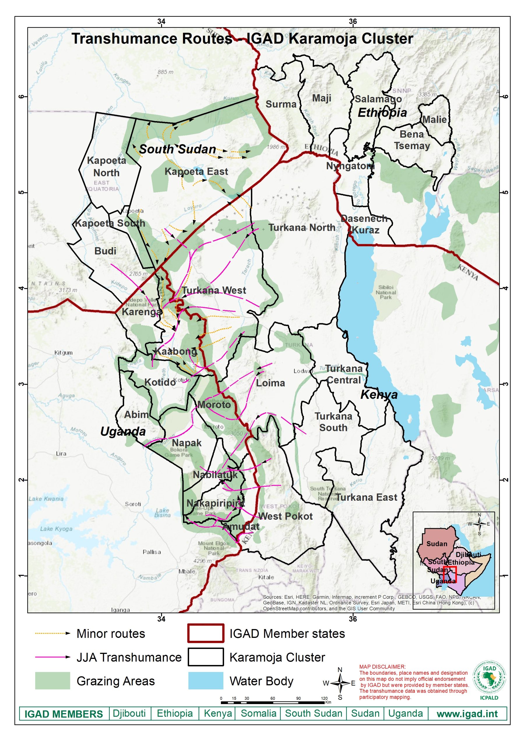
Karamoja Transhumance Routes
Pastoral and livestock movement routes within the IGAD Karamoja Cluster.
View full map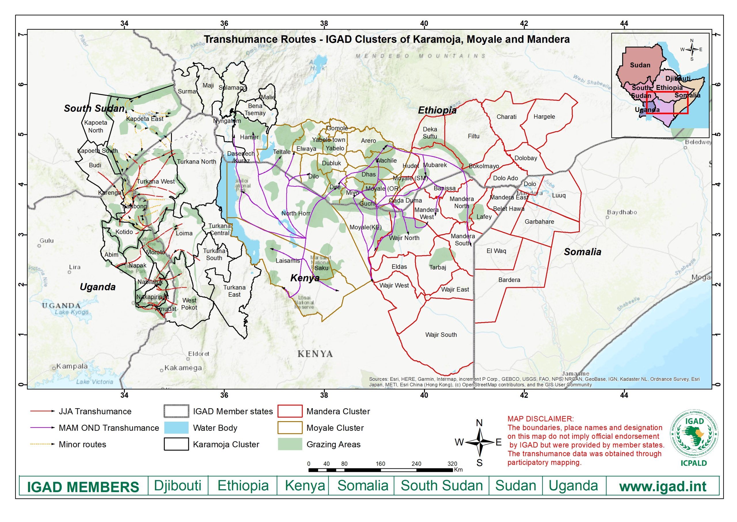
Transhumance Routes – Clusters 1, 2 & 3
Transhumance and livestock movement routes connecting IGAD Clusters 1, 2 and 3.
View full mapHigh-Resolution IGAD Maps
Access high-resolution PDF versions of IGAD cross-border cluster maps, trade facilities, water facilities, transhumance routes and regional reference maps.
