The IGAD Modular Curricula Development for training courses on GIS/RS application in multi-sectoral and spatial planning in the context of IDDRSI Project (ICDP) is a regional technical support program assisted and funded by the Deutsche Gesellschaft für Internationale Zusammenarbeit (GIZ) GmbH. Its goal is to develop and strengthen the capacity of IGAD structures to provide strategic services to member states on information management, decision making and coordination of joint initiatives.
Its purpose is to build capacity and performance of technical staff and decision makers involved in the implementation of the IDDRSI strategy in application of GIS and RS for planning, implementation, knowledge management and monitoring of IDDRSI and its corresponding Country Programming Papers (CPP). The project will be implemented in four phases: Inception, Curricula development, Testing and Closing phase.
There are five modules under development which are;
- Module 1- Agro-pastoral production systems and natural resource management
- Module 2-Market access, trade and corridor development
- Module 3- Basic social services and social safety nets
- Module 4-Disaster risk management, preparedness and response
- Module 5-Conflict prevention, resolution and peace building.
The cross cutting themes embedded in the training material are gender, disaster risk management and conflict for all the modules.
The approach for which the modular curricular was modeled on was based on engagement with the IGAD SC and SC, collaboration with regional centers, use of practical case studies in the region with focus on application of GIS products and not operations. The didactics concept was also used in developing the modern adult learning principles. The IGAD Agricultural and Environment Division and ICPALD have been directly involved and supported the development of Agro-pastoral production systems and natural resource management (module 1).
It is expected that upon completion and following the outcomes of test training, the modular curricula that will be rolled out in three levels; regional level, national (IDDRISI Coordinators) and at country level. A training material would then be rolled out from 2016 consisting of the five thematic modules each containing
For the test training, the target participants were technical managers (subject matter specialists) and senior managers/decision makers.
2.0 Objectives
- Test, access the training material multi sectoral and spatial planning in the context of IDDRISI
- To provide for feedback for the training material content.
3.0 Proceedings
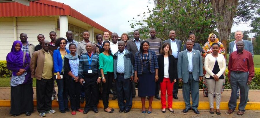
A self-introduction session of the participants comprising of observers (IGAD Secretariat, IGAD GIS team, GTZ) and trainees (IGAD Secretariat, IGAD Specialised centres, subject matter specialist from the IGAD MS) and trainers was conducted. Opening remarks were then made by Farah Abdulsamed on behalf of IGAD. The test training was then officially opened by Dr. Farah, Director of Regional Centre for Resource Mapping for Development (RCMRD). A brief of the project was made by Andre Koiman -GHA consultants’ team leader. This set precedence for thematic presentations done throughout the week.
The general approach for the test training was based on the possible application of GIS in spatial planning for decision making. A guided tour to RCMRD GIS and Remote Sensing labs was conducted for which the participants were exposed to applicability of GIS and RS through various projects the institution is involved.
The test training structure thematic areas was comprised of three broad areas on application of GIS and RS as shown in annex 1 highlighting the key thematic areas of Agro pastoral production systems and natural resource Management;
- Agro pastoral production Systems; Water resource development, watershed management, crop production, livestock production, Mineral resources, Biodiversity conservation and Renewable Energy.
- Natural Resources management; Forest resources and non-wood services, Environmental services, wildlife and forest protection, pasture and land development, control of invader species, soil conservation and Land &water reclamation.
- Case study- This provided in sights on the applicability of GIS and RS as decision making tool.
These sessions were conducted within the 4 day period. At the end of each day’s session, the participants had exercises to tackle that related to application of GIS in real life situations which reference documents; Country programming papers, IDDRISI Result based framework and IDDRSI Strategy. This provided hands on experience, and possible projects that could be done to the subject matter specialists on the thematic areas on application.
Upon completion, the participants were then awarded certificates of participation upon closure of the event.
- Recommendations
Following daily assessments and lengthy deliberations and group discussions by the participants, observers on the modular curricular material, the following recommendations were made:
To the consultants;
- To address the gaps identified from the daily evaluations and plenary discussion during the test training and the observers in the final material.
- To restructure the content in terms of time allocation for the respective thematic areas since on module 1 is broad.
To the GIS Team;
- To support the roll out of the training content upon completion during the close up phase of the project and its subsequent use.
5.0 Way forward
- GHA consulting team to finalise the material content capturing the feedback from the participants during the test training. The expected final multi-sectoral modular curricular will consist of;
- A training manual for trainees-technical and senior managers per thematic areas including maps and data
- A trainer guideline including a guideline including a guide on teaching methods and logistics.
- An adult learning tool for facilitating the learning inclusive of moderation kits and evaluation sheets


